
Both kids have become really interested in maps. We have found a number of their fictional Viking stories include maps and the kids love looking at them and figuring out where the different events written about in the stories occurred.
So it was no big surprised when I suggested they try to create their own maps that they both immediately went for a Viking/ Dragon fictional set of islands.
We dug out a number of our How to Train Your Dragon books and the kids used the maps included in them as inspiration. And yes my youngest did create an island in the shape of a dragon.
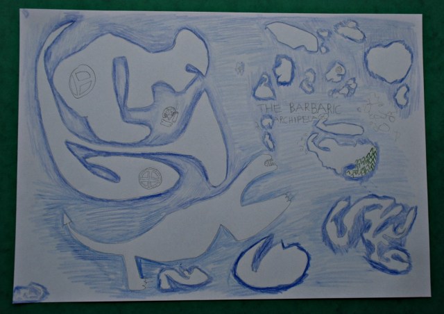
But even though the kids were creating fictional maps, for fictional characters they were still talking about how to denote certain things – trees, a small village, beaches on the island, where should they place their compass, names, we even discussed if my son’s map was a true Viking map it would need to be somewhere in Scandinavia, so which direction would the Roman Empire be and where would America be (again this is important because of what happens in the How to Train Your Dragon books). For a totally fictional map they both still thought about a lot about real map work points.

And the idea of creating their own map to go with a game or story they are writing really seems to be appeal to them.
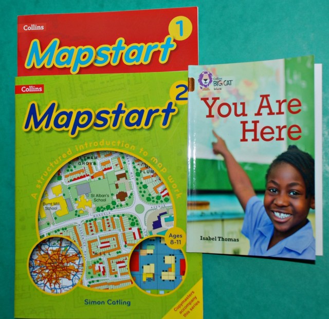
So after all the fun of creating a map of a group of islands we started talking about creating maps of areas within islands – so possibly a map of a village, or a smaller area. We started looking at our Collins Mapstart 2 (Collins Primary Atlases) books and the kids used a reader – You Are Here; Maps and Why We Use Them: Band 12/Copper (Collins Big Cat)
and we discussed how they could denote roads, verse railway lines verses rivers. We also spoke about using a key instead of always writing out the words for every item. And again they created a map for a fictional place but this time it was a more detailed map.
I have mentioned before the Mapstart books that I bought the kids and they have been really great at giving us examples of maps, maps that the kids can look at and see how the converted an area into a map.
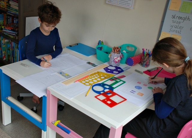
My kids have mostly been drawing their maps freehand but after looking at some examples in the mapstart book my oldest has started trying to creat a few maps which are more accurate – using some grid paper and some stencils.
We have now gone onto talking about contour lines and so much more – but I will put all that into a different post with a picture of the island we are trying to make.
The grid paper she is using is this one from Activity Village – Grid paper (we use it a lot for Maths). The Stencils – the yellow circle one I have no idea where I bought that one and the other colourful shape stencils are these ones – Learning Resources Primary Shapes Template Set
Disclosure : I bought the Map start books and the How to Train your Dragon books for the kids. The BIGCAT reader You Are Here was given to us in a group of BIGCAT readers.
I do include Affiliate links. If you follow an affiliate link and go on to purchase that product, I will be paid a very small commission, however your cost will remain the same. I only include affiliate links for products that we use and love.


Very cool!
LikeLiked by 1 person
Pingback: Some of the Home Education Question I am being asked | ofamily learning together